Old Ramsgate (then and now)

Identical scenes from the town of Ramsgate (Isle of Thanet) from past centuries and today

/* */

Tuesday, November 20, 2007

Home Page

Welcome to "Old Ramsgate"...

.
..
Identical scenes from last century and today...
.
.


1897-1905
2006
I hope you enjoy this blog - it's a collection of photos of the town of Ramsgate during it's early heyday, compared with the same scenes today, over a hundred years later. I find it interesting to see what has changed over all the years.
Click on a link (to the left) under "Recent Posts", to visit different areas of the town, and I hope you enjoy the journey back in time!
<--->

A description of Ramsgate in a Victorian journal of the Nineteenth century:
"The streets of Ramsgate are well paved or macadamised, and brilliantly lighted with gas. There are establishments and a savings bank, with a literary institute, assembly-rooms, a small theatre, several good libraries, dispensary, town-hall, custom-house, music-hall, gas-works, water- works, &c. An excellent promenade on the West Cliff has been laid out in an ornamental manner, and forms a delightful source of healthy recreation. The bathing-machines are under the East Cliff where also, as well as in front of the harbour, there are well-appointed warm baths, &c. The markets are extremely well supplied meat, excellent fish, & ; and few places on the coast are so cheap, as well as healthy and agreeable for a summer’s residence.
We need not be surprised at the popularity which Ramsgate continues to enjoy as a watering place, when these and many other advantages present themselves for the convenience of the visitor.
The environs of Ramsgate are charmingly picturesque and diversified. Several handsome residences are here. East Cliff Lodge, pleasantly situated about a mile to the north-east of the town, is a large marine villa, belonging to Sir Moses Montefiore, Knight. The caverns at East Cliff deserve particular notice: they are formed by an excavation at the distance of thirty feet from the cliff, and parallel with it, descending gradually to the level of the shore. This subterraneous passage receives its light from arches of such large capacity as to resemble rooms, which are cut at right angles through the chalky cliffs opening to the sea and these arches being in summer carpeted with turf, and covered with shrubs and flowers, appear very picturesque. The lowest arch terminates in a passage leading directly to the beach.
Sir Moses Montefiore has, at his own expense, erected a synagogue at Hereson.
About a quarter of a mile westward of Ramsgate, is Ellington. In the reign of Elizabeth, this estate became the property of the Spracklings, several of whom lie buried in the chancel of St. Lawrence."
<-->

*** COMPETITION ! ***
Below is a very old picture from 1788, which shows "The Bathing Place" at Ramsgate...
Does anyone know exactly where this was, from looking at the picture?
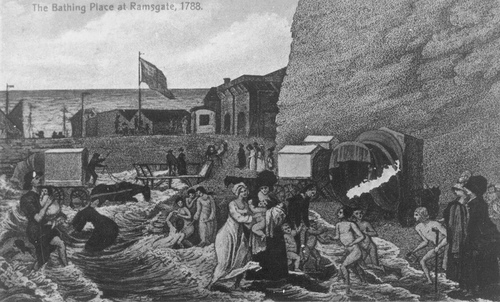


Feel free to add a comment with your answer!


Acknowledgement:
Many Thanks to Janet & Richard's Genealogy Homepage for their kind permission to use many of the original postcards from their personal collection. More 'Ramsgate in old postcards' and other useful information can be found on their site here, or from the links page.
Recent Updates:
20/11/07 - Amended links to posts in template to ensure they are always visible.


http://cgi.ebay.co.uk/ws/eBayISAPI.dll?ViewItem&item=151176561348
"Ramsgate - Then & Now" has recently been published by the History Press, in an attractive 96 page book. This first edition includes all of the old & new images from this site, as well as many more, and over 10,000 words of supporting captions and historical information, to complement the images.
If you have enjoyed visiting this site, why not buy the book, which would make the perfect gift for any Ramsgatonian, old or new!
£9.99 (inc. P&P)


.

Labels: , , ,

Sunday, November 18, 2007

The Town

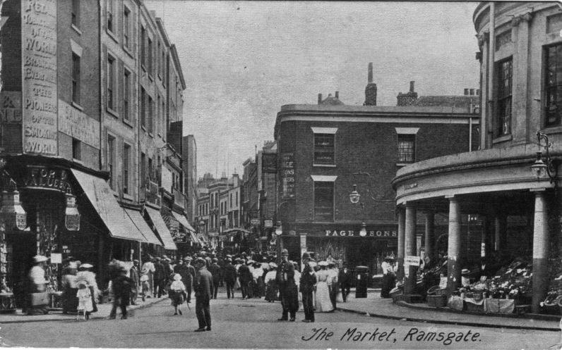
Ramsgate High Street, c.1905

Ramsgate High Street, 2006

The main Precinct in Ramsgate High St, this is the cross roads with Harbour Street straight ahead, King Street to the left, and Queen Street to the right. The original building on the right with the pillared frontage is now the Halifax building society, with the front facade having been redeveloped, minus the attractive pillars. Page & Sons is now the Harbour Parade Bar.

<--->

High Street, looking towards Queen Sreet, 1907

Same view, 99 years later!

Original picture: This was taken during the "French Visit" of August 6th, 1907. The pillared building on the left is now the Halifax. As in the previous picture, the frontage has changed significantly, but this distinctive corner building is still recognizable. I think these days Health and Safety would have something to say about that crowd of people standing on the roof, with no safety railings!

<--->

Vale Road, c.1890

Vale Road, 2006

The Vale Tavern still very much in use! Scene hasn't really changed that much except for the obvious addition of cars. Any more changes? Play "spot the difference"!

<--->

Plains of Waterloo, c.1905

Plains of Waterloo, 2006

No. 50 is still a grocery store, a hundred years later!

<--->

Spencer Square, c.1900's

Spencer Square, 2006

The original bowling green is now tennis courts. Carlton House was originally a YMCA hostel in the early picture, not any more! Other than the new pavillion/refreshments building, not a lot else has changed, probably because these buildings are all grade 2 listed.

<--->

St. Mildreds Road, c.1900's

St. Mildreds Road, 2006

Nice to see the trees still remain!

<--->

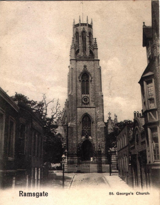
St. George's church, c.1895 and 2006

St. Augustine's Abbey, c.1900's St. Augustines Abbey, 2006

Designed by the famous local architect, Augustus Pugin. Note the two lion statuettes above the gate... see if you can spot these same statuettes in a picture of another famous Pugin building on this site

<--->

No. 6, Albion Hill, 1915

The same building, 2006

Since repaired!

The original photo shows no.6 Albion Hill, damaged by a Zepellin airship raid during the First World War. This was likely one of the first times the town had ever experienced an aerial bombardment, judging by the look of wonderment on some of the local's faces.

<--->

Aberdeen House, c.1905

Aberdeen House, 2006

<--->

Hereson Road Station, 1958

Same view, from the platform, 1958

Site of Hereson Road station, 2006

The Hereson road entrance to the 'Scenic Railway' was opened on July 31st, 1936, and closed in 1964. It joined with the main Station at Ramsgate Sands (see Ramsgate Sands and eastcliff post).

The tunnel entrance was filled in, and the station site is now a second hand car dealership.

<->

The old Ramsgate Town Station (c.1900)

Site of the old Ramsgate Town Station, 2007

In the mid-1800's, the old windmills on this site were pulled down to make way for the original Ramsgate town railway station. It was located at the top of Margate Road, next to the Hovis Mill site.

During the First World War, the station received a direct hit from a Zeppelin air raid, and was never used again. In 1926 McAlpines built the railway through from Margate to Canterbury and the site lay derelict for many years. After the Second World War the site was cleared and the existing Chatham Court flats were built in it's place.

<->

Ramsgate Mill, 1900

The Ramsgate Mill as it was in 1900. Note the horse and cart at the side of the mill, and the old railway on the far left

Ramsgate Mill, 2007

The additional frontage to the main building (the screen room) was constructed in the early 1900's and the large silo to the left was built in 1935.

The site was closed in 2005 as Rank Hovis deemed it was no longer commercially viable. The site is up for sale, and will likely be converted into residential flats. The main building is grade 2 listed.

<->

Ramsgate Library, 1904

Ramsgate Library (remains of!), 2007

The grand building which was Ramsgate Library was built in 1904. The original postcard shows it during the winter time. The park in the original photo has long vanished, and has since been built on with houses, as can be seen in the modern photo. Sadly, only a few months away from it's centenary, the library was completely destroyed by an arson attack in August 2004, with only the Edwardian facade remaining. Plans to rebuild it are progressing well.
.

Harbour Street, 1900

Harbour Street, 2007

<->

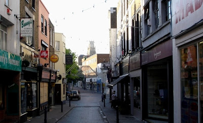
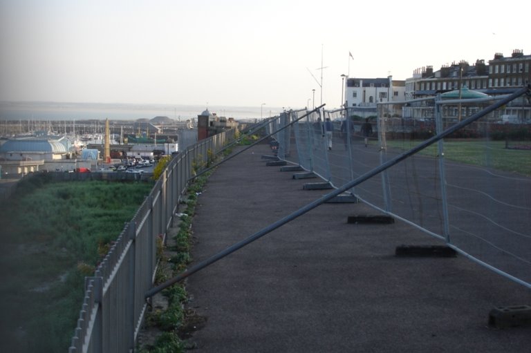
High Street, c.1905


High Street, 2007

Sadly this view from the top of Ramsgate High Street is obscured by temporary hoardings

<->

Grange Road, c.1905

Note the Windmill in the centre of the picture, on the left side of the road. The windmill was one of several in Ramsgate, and was demolished many years ago. It is now a row of shops.


Grange Road, 2007

Without the Windmill!

<->

St. Lawrence High Street, c.1905


St. Lawrence High Street, 2007

The differences between these two scenes is dramatic! The entire row of buildings on the right hand side of the High Street were demolished during the 1930's and '40's, to enable the road to be widened, so as to cope with increasing traffic demands. The Petrol Station and post office now stand in their place, with newer houses set further back. The fronts of the original terraced buildings would have been where the hatching is in the middle of the road in the new picture. You can also just make out the Wheatsheaf pub in the middle of the picture (behind the white road sign), and it was originally painted pink!

<->

Augusta Road, c.1905

Augusta Road, 2007

---------

Labels: , , , ,

Saturday, October 20, 2007

East Cliff


View from the East cliff, c.1900
Same view in 2006
---
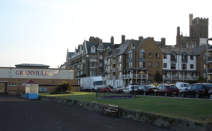
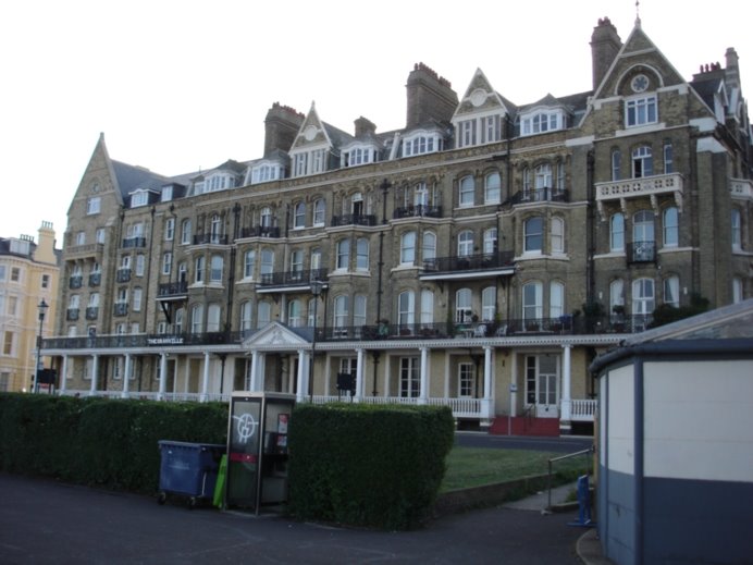
Granville Hotel, c.1900

Granville Hotel, 2006
The Victorian shelter in the foreground is still there, (albeit with a new coat of paint!) but the bandstand and ornamental garden behind it have since been replaced by the slightly less attractive Granville Theatre building
---

Wellington Crescent, c.1900

Wellington Crescent, 2006
---

East Cliff Promenade, c.1900

Eastcliff Promenade, 2006

---

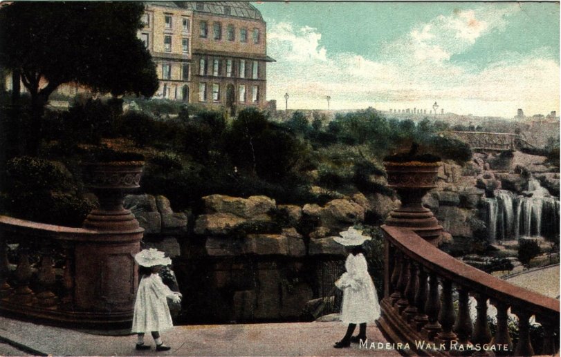
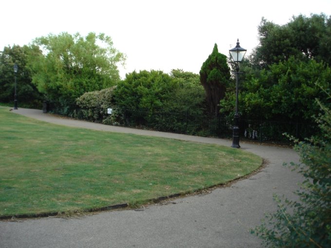
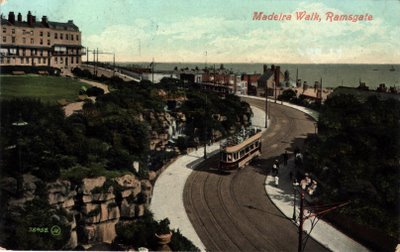
Madeira Walk, c.1900

Madeira Walk, 2006

It is clear to see a lot more growth in the shrubbery here compared to last century, with the trees and shrubbery no longer cut back so much, but slowly taking over!
---

Corner of madeira walk, c.1900
Same view in 2006.

Again, the trees and shrubbery are a lot higher, obscuring the view - no longer seems as ornamental and neatly tended as the new growth in the original picture

---

Another veiw of Madeira Walk, c.1900

Madeira Walk, 2006
---
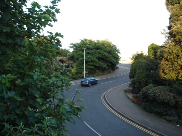
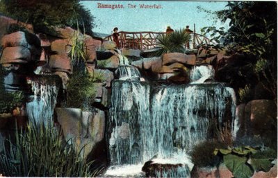
The Waterfall (Madeira Walk), c.1895

Exactly the same in 2006!
(I guess water and rocks don't change much over time!)
Note the ornate wooden bridge in the original picture was since replaced with a stone one, likely in the early 1900's. The original bridge shown is also identical to the one crossing the lake in the original scenes from Ellington Park
---
Another picture of the waterfall, c.1900
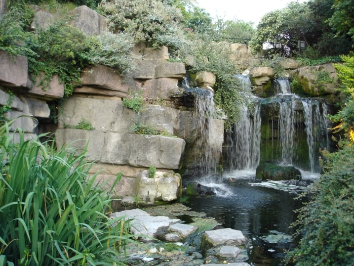
Waterfall, 2006
---
Madeira Walk, c.1900

Madeira Walk, 2006
---
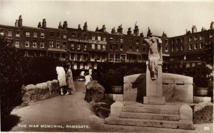
The Peace Memorial, Albion place, c.1920
The Peace Memorial, 2006
This memorial is called "Destiny" and was unveiled by Dame Janet Stancomb-Wills to all the inhabitants of the town, and the animals. Contrary to the caption on the original postcard, it is not a war memorial, but a Peace memorial. It is completely untarnished by time and the monument remains identical to the original picture in every detail. Note however how the bridge on the left (crossing above the waterfall) has been replaced by a stone one in the original picture, rather than the wooden bridge shown in the earlier pictures of the waterfall at Madeira walk. Also as in the other pictures, the modern setting is more overgrown!
---

Compare the houses from the original photo and the modern one, and it is clear to see the gap in the terrace. Perhaps these two properties were destroyed by bombs in WW2? The buildings here are all listed now.

---

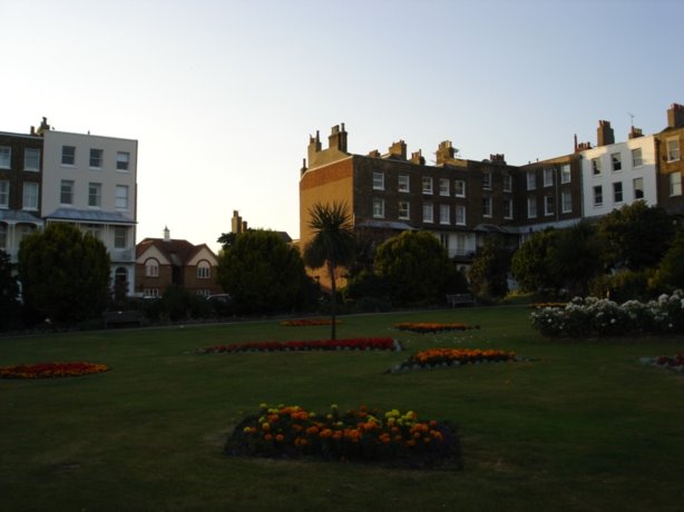
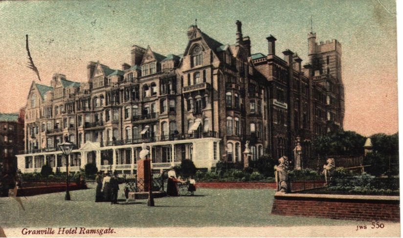
Granville Hotel, c.1900

Granville Hotel, 2006

The ornamental garden guarded by the two lion statuettes to the right of the original picture is now the corner of the Granville Theatre (cinema) shown to the right of the modern picture. The Granville Hotel has since been converted to residential appartments for some years now

---

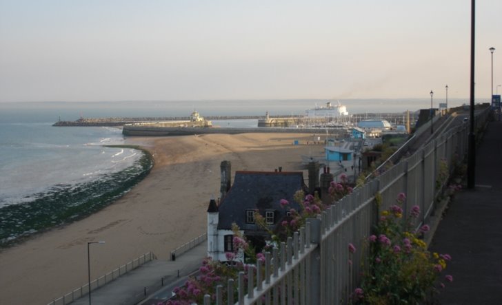
The old Ramsgate station from the Eastcliff, c.1900

Ramsgate harbour, 2006

The blue roofed building in the background (now the casino) was the original station building. When the railway closed, the terminus and railway tracks were transformed into the pleasurama amusement arcade around the 1930's, which then burnt down in an arson attack in the late 1990's. The overgrown patch of ground is where it used to stand prior to it's demolition. The land has now been set aside for luxury apartments and development.

---

Winterstoke Gardens, 1926

Winterstoke Gardens, 2007

Much the same, with the fountain turned off!

.---

Winterstoke Gardens Pavillion, 1926

Another view of Winterstoke Gardens Pavilion, 1926

Winterstoke Gardens Pavilion, 2007

Quite a sorry sight compared to it's original glory days! In it's heyday in the '20s and '30s it was a pleasant spot to congregate and watch bands and concerts in the park. Those days are long gone and nowadays it is popular as an unofficial skate park... with the walls covered in graffiti

.

Labels: , , ,